|
| About Norfolk
| Place Names | GPS
Preface | GPS
Norfolk
| GPS Cemeteries | Back |
|
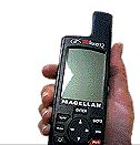
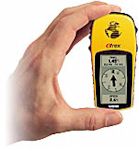
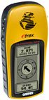
GPS Preface You can find small cemeteries that are not on your map, a specific gravestone in a huge cemetery, and historical sites that no longer exist, such as your ancestors' homestead. All you need is a handheld Global Positioning System (GPS) receiver -- and the location's coordinates. In May 2002 we began adding Norfolk GPS coordinates to this web site. [2012 Update: Today we have
alternatives. May cars now come with GPS built into the dash. Even better,
small digital cameras such as Canon's PowerShot SX260 or S1oo can record the
GPS location to each photo's EXIF data information.] GPS receivers supplement, rather than replace, other direction aids such as a compass or map. They shine as navigational solutions when looking for things too small or old to appear on your map. To find larger locations such as cities, maps get our vote as the right tool for the job. Even those who do not use GPS receivers themselves may wish to add our GPS coordinates to their genealogies, so other family members can use the coordinates as navigational guides to specific ancestral sites, either now or in the future. GPS coordinates are measures of latitude and longitude. Don't let that scare you. You do not need to understand latitude and longitude to use a GPS -- anymore that you need to understand how your automatic transmission works to drive your car. Mastering the gear shift is all it takes. Latitude measures how far north or south of the equator a site is. Longitude measures how far west of Greenwich, England a site is. Since virtually all of Norfolk County is north of the 42nd degree ('parallel') of latitude, and more than 80 degrees west of Greenwich, all we need to find is the number of sub-degrees, called "minutes," to pinpoint any spot within about 25 feet (8 metres) or less. While "within about 25 feet" may not sound too precise, in practice it is usually more than enough. Today's GSP receivers display "minutes" to three decimal places. Concentrating on just the first two decimal digits (hundredths of a minute) makes finding even small objects like gravestones easy. Since all of Norfolk County is north of the same degree of latitude -- N42 -- and west of the same degree of longitude -- W 080 -- this site abbreviates coordinates to just minutes, so a typical GPS coordinate is written as "[GSP:32.161/03.210]" which is easily expanded and recorded as -- N 42 32.161 and W 080 03.210 -- for compatibility with today's GPS receivers. An example: the abandoned Mills
family cemetery is on Highway 3 just west of Simcoe. But it is easy to miss
unless you know you are looking for GSP:50.320/20.800, which is written out in
full as There are more Norfolk examples here:
GPS:Norfolk. |
|
|
|