|
|
About Norfolk | More Recently | GPS:
is catching on|
Back |
| The following
article is from the 7 Apr 2002 issue of Eastman's Online Genealogy Newsletter,
and is copyright 2002 by Richard W. Eastman. It is re-published here with
the permission of the author. |
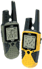
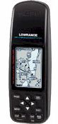
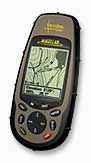
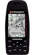
| Using a GPS for Genealogy Last week I wrote about the U.S. Government's Geographic Names Information System (GNIS). It is an excellent resource for locating old cemeteries, even small ones of only a dozen graves or even less. As I wrote last week, "The information includes the exact latitude and longitude of each named feature." You can read that article at: http://www.ancestry.com/library/view/columns/eastman/5499.asp The geographic coordinates are useful for a couple of purposes. First of all, it is rather easy to find exact latitude and longitude of the cemetery on GNIS and then to find those coordinates on a good map of the area. However, with the use of a high-tech device, you can also easily obtain real-time instructions on how to drive directly to the cemetery. The Global Positioning System (GPS) consists of a constellation of 24 active satellites (and one or more in-orbit spares) orbiting the earth every 12 hours. Four satellites are located in each of six orbits. The orbits are distributed evenly around the earth and are inclined 55 degrees from the equator. The satellites orbit at an altitude of about 11,000 nautical miles. These satellites broadcast time information that is accurate to a few microseconds. Receivers on the ground can decode these time signals, apply some mathematics, and thereby determine the exact location of the ground receiver, plus or minus fifty feet or less. Global Positioning System was first used by the military some years ago and then, soon after, was adopted by the airlines. Using this technology, airline pilots and military personnel can determine their exact location at any time. The early GPS receivers had a price tag of tens of thousands of dollars. However, as the technology matured, prices dropped. About ten years ago GPS receivers fell into a price range that became attractive to fisherman, hunters, backpackers and RV owners. In fact, recently I have seen simpler GPS receivers on sale at the local Wal-Mart store for $99.95. However, most GPS receivers typically range from $129 to $999 for consumer models. You may even find GPS navigation units built into automobiles, although usually at prices well in excess of $1,000. The thing that fascinates me is that the $129 units are just as accurate as the $1,000 units: both can determine your location within 50 feet or less. Paying higher prices does not increase accuracy. It does, however, increase the number of features available. As you move up in price, you find GPS receivers with built-in maps, larger displays, and color displays. The high-end units made for automotive use will even talk to you in order to warn you of upcoming turns. The computerized speech units are a major safety enhancement, as you do not need to take your eyes off the road to read the map on the GPS receiver's display. I have used a number of GPS receivers in recent years and presently have an eMap that is manufactured by Garmin (http://www.garmin.com/products/emap/). This particular unit is typical of today's GPS products: it slips into a shirt pocket, weighs six ounces, operates on two penlight cells, and has a built-in map of all the major highways, lakes, rivers, railroad tracks, and other major features within the United States. It also has the capability of downloading detailed map information for a small area, including side streets and topographical mapping information. The eMap has a "street price" of about $175. So why would genealogists use a GPS receiver? To find the cemeteries! If you wish to drive to a cemetery that may contain the gravesite and tombstone of an ancestor, you can simply enter the latitude and longitude of the cemetery into your GPS receiver, and it will point the way. A few years ago I used a newly-purchased GPS to locate several small cemeteries in Epping, New Hampshire. I was looking for the grave of Daniel Dow, an ancestor who lived in Epping in the late 1700s and early 1800s. I know little about this man other than his name and the dates and locations of his birth, marriage, and death. I was hoping to find a few more details. The fact that it was a warm spring day and I had a brand-new convertible sports car added to the enticement, of course. I first looked on the Geographic Names Information System's Web site and printed out a list of all the cemeteries in Epping New Hampshire. This list included latitudes and longitudes. I then jumped in my sports car, turned on the GPS receiver, and entered the same latitudes and longitudes into the GPS receiver (which can store up to 500 of these "waypoints." Once that task was completed, I started the car and sped off. I selected the first cemetery, or waypoint, and the GPS receiver pointed the way. When I say "pointed the way," that is exactly what it did. The Garmin GPS receiver has an arrow that points straight up if the desired destination is straight ahead. If the destination is to the left or right of your automobile, the GPS receiver's arrow points in the appropriate direction. The receiver also has digital displays that show your speed, the distance remaining to the waypoint, and a lot of other information. The roads in Epping certainly are not all in a straight line. It is a typical rural New England village with winding back roads, many of them unpaved. I could not always follow in the exact direction that the arrow indicated, but I usually was able to go in the approximate direction. As I got closer and closer to the designated cemetery, the digital readout for "distance remaining" approached zero. I easily found several larger cemeteries, but all proved to have no evidence of my elusive ancestor. I punched in the coordinates for the final cemetery on the list and headed off, following the advice of the GPS arrow. I soon found myself on an unpaved road that led through dairy farming country. The "distance remaining" display kept counting down, one mile... one-half mile... five hundred feet... one hundred feet... fifty feet. I didn't see a cemetery and continued driving. However, the "distance remaining" started counting back up again. I turned around at the next farmhouse and headed back. The "distance remaining" display repeated the earlier scenario. It counted down to thirty feet and then started counting up again, all with no cemetery in sight. I made another U-turn and started a third pass although at greatly reduced speed. Again, the digits counted down. I then found that the display never went to zero. Instead, it would count down to thirty feet and then start counting up again. I overshot the location, so I backed up until the display said "thirty feet" and then stopped. The arrow pointed 90 degrees to my left. I turned the engine off and looked around. There was no cemetery in sight. Being curious, I got out of the car and started walking to the left. I counted off thirty feet as I walked off the road and through the thick underbrush. At approximately thirty feet from my automobile, I stopped and looked around. Again, no cemetery was visible. However, I seemed to be standing on something substantial, even though it was covered with brush. I leaned down, pulled the brush away, and discovered that I was standing on a tombstone that had apparently fallen over many years ago and was now covered with New England's finest thick brush. In the next few minutes of poking through the thick underbrush, I found five more horizontal tombstones. With a bit of work, I was able to read the lettering on each. Thanks to the Geographic Names Information System and my GPS receiver, I had located a cemetery that was invisible from the road only thirty feet away. I doubt if I would have ever found that cemetery, had I been given a less precise description of its location. GPS receivers have many uses besides genealogy. You can navigate down strange roads, find residential addresses that would be elusive otherwise, and even find fast-food restaurants while on cross-country trips. Best of all, a GPS receiver is the ultimate salvation for the male ego: you never, ever have to ask for directions. I would suggest that a GPS receiver is an excellent tool, both for cemetery-hunting and for non-genealogy purposes. If you have an interest in adding this high-tech marvel to your genealogy toolkit, I would recommend that you first spend some time on the Web learning about the capabilities of these fascinating devices. A few of my favorite GPS Web sites
include: |
|